- Home
- Core Focus
- Natural Systems
- Minimum Flows and Minimum Water Levels
- Aucilla & Wacissa Rivers
Aucilla & Wacissa Rivers & Associated Springs Minimum Flows & Levels
 About the Aucilla & Wacissa Rivers
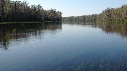
The Aucilla River originates from artesian springs in central Georgia and flows south approximately 89 miles to the Gulf of Mexico. Along its path it traverses marshes and lakes in northern Florida, karst limestone east of Tallahassee, and sinks and resurgences below the Cody Scarp before finally rising at Nutall Rise and flowing into the Gulf of Mexico. The river picks up tannins from decaying vegetation and acquires a black tint as it flows south.
The Wacissa River is a major tributary to the Aucilla River and provides a substantial portion of the total Aucilla flow, particularly at low flows. Twelve major springs feed the Wacissa River as it flows through swampy lowlands in the Aucilla Wildlife Management Area. The Wacissa River diffuses into numerous braids for several miles before flowing into the Aucilla River.
River Minimum Flows & Levels
The District's Minimum Flows and Levels (MFLs) program is a means to ensure water availability for the present and future, and to prevent "significant harm" to the area's natural resources. The Florida Legislature has directed the five water management districts to establish MFLs for streams, springs, rivers, lakes and other priority water bodies. In accordance with the District's priority MFL schedule (PDF), work has been completed on the draft MFL for the Econfina River, which is scheduled to be finalized by the end of 2015. As defined by statute (Section 373.042 Florida Statutes), "the minimum flow for a given watercourse shall be the limit at which further withdrawals would be significantly harmful to the water resources or ecology of the area."
The District has an accelerated schedule to establish MFLs for its priority water bodies. The District's MFL Program is a science-based process, which the District Governing Board uses to establish MFLs. This process uses the best information available to determine recommended MFLs. Before adoption by the Governing Board in the District rules, the science supporting the MFLs is subject to a peer review process initiated by the District.
The District voluntarily submits to independent scientific peer review for all MFLs established. This practice ensures that the highest degree of scientific certainty is provided prior to adopting a MFL by rule.
Supporting Technical Data & Reports
The final technical report for the Aucilla and Wacissa Rivers MFL is available for download. The report file size has been compressed for shorter download times. While the resolution should be adequate for online reading, please be aware that the quality of portions such as figures may be reduced. A higher resolution file of the document may be obtained upon request.
- Executive Summary (PDF)
- Final Aucilla and Wacissa Rivers MFL Report (PDF)
- Aucilla and Wacissa MFL Report Appendices (PDF)
- Aucilla and Wacissa River Peer Review Report with Author Responses (PDF)
- Data Collection Report for Environmental Fluid Dynamics Code (EFDC) Model (PDF)
Get More Information
Contact the MFL program at 386.362.1001 with questions.